More than 140,000 NSW homes still without power and more storms expected on Saturday
- Follow our Australia news live blog for latest updates
The NSW government has declared a natural disaster in three areas, as wild weather continues across Australia this weekend, with storms, heatwaves, and a possible cyclone predicted.
Support from the state and federal governments will be rolled out to individuals, communities and businesses in Port Stephens, Maitland, and the Snowy Valley.
Emergency services minister Jihad Dib said: “If you live in a suburb that is within the local government area, then you will qualify for that” and that “adjustments” could be made.
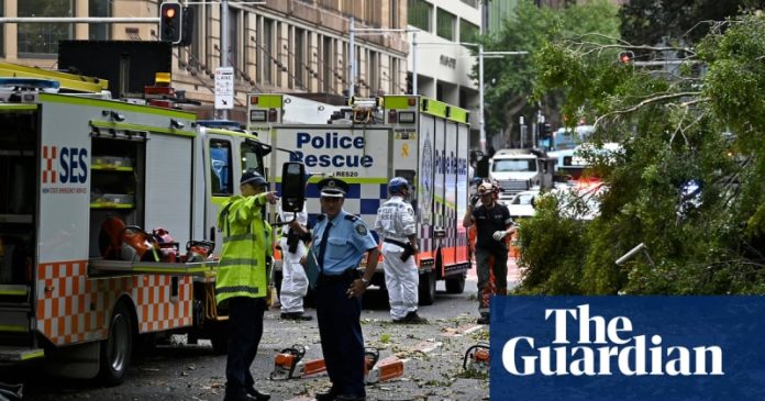
This week has seen monster hail and flooding in NSW, strong winds tearing roofs off buildings, and one death.
An 80-year-old man died in Cowra after a tree fell on his car in NSW.
Hundreds of thousands of lightning strikes were recorded, leaving more than 140,000 homes without power across the state.
Ausgrid said wind gusts of up to 100kmph left more than 68,000 Sydney homes without power on Friday night, and 28,000 were still without power on Saturday morning, along with another 15,000 in Newcastle and the Hunter region.
There have been almost 7,000 calls for help from the NSW state emergency service (SES). They were mostly for fallen trees and damaged properties, but there have also been four flood rescues involving up to 12 people.
The NSW SES has warned about possible flooding in various areas and says people should monitor the SES’s website and Facebook page, listen to their local ABC station and check the Bom website.
It has also warned people to stay out of flood waters and to stay vigilant in areas at risk.
Assistance measures can include concessional loans, transport subsidies, protecting homes or assets, and restoring essential public assets.
Dib said they were simultaneously working on the emergency response, and the recovery.
“That’s an incredible effort and it actually shows everybody working together, local government, state government and federal government,” he said.
“In NSW, we have severe weather warnings current for damaging winds and heavy rainfall between Coffs Harbour and Sydney, the mid-north coast and the Hunter,” Bom meteorologist Dean Narramore said on Saturday.
“That will ease later today but we’ve already seen falls of 50 to 150mm between Port Macquarie and Maitland, with the heaviest falls seen in the Barrington Tops [national park],” he said.
The park’s Carey’s Peak got 281mm in the 24 hours to 9am Saturday morning, leading to minor to moderate flood warnings in the area.
Narramore said wind gusts reached 120km/h in Wattamolla, and 93 at Sydney Airport.
“Lastly for NSW we also have damaging and dangerus surf conditions with warnings current for much of the NSW coast,” he said.
Narramore said conditions in NSW would ease on Saturday afternoon and overnight, with isolated showers and gusty winds predicted for Sunday, and a dry, warm and sunny Monday right across NSW.
Angus Hines, also a BoM meteorologist, said there was “an absolute abundance of moisture in the atmosphere” over north-western WA, with two tropical low pressure points developing. One of them, near Broome, will develop and strengthen over the weekend and move towards Exmouth.
“It will stay over the water but close enough to the country to have a significant impact on the weather for these northern communities,” he said, adding that there would be heavy rain and damaging wind gusts.
The Kimberley coast could see up to 200mm of rain, Hines said.
It will stay as a tropical low pressure system until Sunday, when there is a “high chance” it will develop into a tropical cyclone, but by then it will be moving away from the coast.
The south and east of the state is facing a heatwave, with temperatures in the high 30s and low 40s over the next week.
– with AAP

